Calakmul (Kalakmul) Campeche

“City of the Two Adjacent Pyramids”
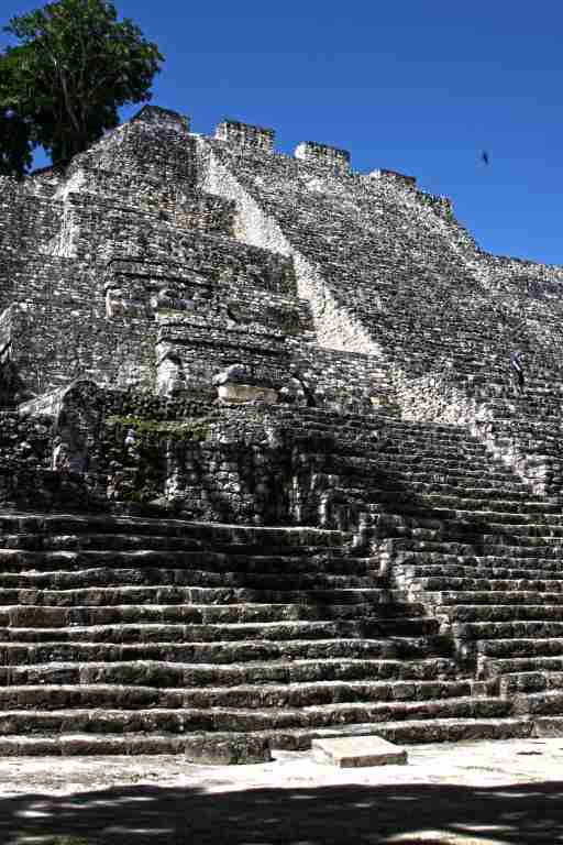
Maya (ca – two, lak – adjacent, mul – artificial hill or pyramid)
Also Known as Ox Te’ Tuun (Three Stones) and also Chiik Naab (No known meaning)
Named by botanist Cyrus L. Lundell who 1931discovered the Maya city of Calakmul
HISTORICAL NOTES
DATES
Timeline Graph
Specific Dates
600 BC – Beginning occupation
514 – Earliest inscribed date. Calakmul is a powerful city in the Petan. It is the central power fo outlying towns and villages.
537 – King Cu-Ix appears in Yaxchilan lintel
546 – King Cu-Ix appears on Stelae at Naranjo. Calakamul is courting favor with other cities and cementing strategic relationships in the Petan area. Calakamul and alies surround Tikal
550 – begins the period of building structures for next 150 years
561- King Sky Witness installs ruler at Los Alacranes. Also overlord of Caracol
562 – Sky Witness defeats the great city of Tikal. Sacrifices King Wak Chan K’awiil
572 – Death of Sky Witness
695 AD – King Jaguar-Paw of Calakmul was defeated by Ah-Cacaw of Tikal
810 – Recorded history stops
850 – Continued occupation
1450 – 1550 – Largely abandoned. Used as a ceremonial site.
LOCATION & DESCRIPTION
Geographic location
LOCATION & DESCRIPTION
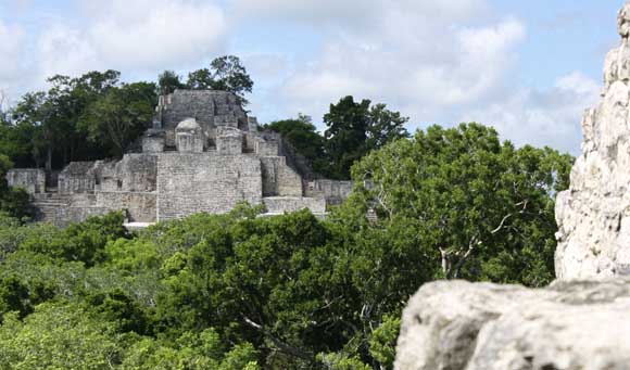
Calakmul is a large Maya archaeological site in Campeche Mexico deep in the jungles of the Petén Basin. It is remote; 60 kms from Highway 186 (the highway between Campeche and Chetumal) and 35 kms from the Guatamalan border. The vegetation is lush and because it is in such a remote location, there is an exciting array of wildlife both getting to and at the archeological site. There are over 230 species of birds.
The site is thick with jungle and relatively flat.
Map
Entrance
Parking, tickets, publications, first aid and caretaker.
Satellite phone, information and interpretive signs.
MAJOR GROUPINGS & STRUCTURE DESCRIPTIONS

HOURS
Open Daily from 8 am to 5 pm.
There is a watchman at the gate who will charge you the standard fee & extra for video cameras.
Admission 2013 48pesos. Free on Sundays for nationals and Mexican residents.
Allow at least 4 hours, especially if you like to climb. More if you like to read each plaque and take pictures.)
RECOMMENDATIONS
Take good shoes as there is plenty of climbing- and a fair amount memory and batteries for your photographs. We recommend you stay on the designated paths as you can easily get lost in the dense bush jungle.
As this is site is in a remote jungle area, take water and insect repellant. The mosquitos can be vicious. There are no restaurants or food vendors.
Dress according to the season you are visiting. Rain can advance quickly)
Calakmul

GETTING THERE
GPS – N18.105.392 W89.810.829
Busses
Many buses go to Xpujil. Once there take a taxi to the site. For 900 pesos 2 ways. The driver waits for you.
Tours
There are a few tours on the internet.
Drive from Villahermosa:
Take Highway 186 to Escárcega and then East to KM 156. Turn right at signs for Calakmul. 458 KMs – 6.5 hours.
From Campeche:
Drive Highway 180 South to Champotón. Turn to Highway 261 to Escárcega. Turn on Highway 186 towards Chetumal and drive to KM 156. Turn right at signs for Calakmul. 458 KMs – 6.5 hours.
304 KMs – Approximately 4.5 to 5 hours