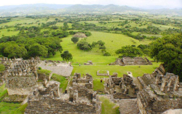
Tzeltal Mayan “House of Stone”
Ancient Mayan name “Po” or “PoPo”
LOCATION & DESCRIPTION
Geographic Location
Located in the highlands of the State of Chiapas in the Ocosingo Valley, Tonina is just off the highway that leads from San Christobal de las Casas down to Palenque. It is 13 KMs (8.1 miles) from the town of Ocosingo. It is 800 to 900 meters above sea level.
Toniná sits on a limestone ridge next to Río Jataté,
Map
Entrance
MAJOR GROUPINGS & STRUCTURE DESCRIPTIONS
HOURS
Open Daily from 8 am to 5 pm.
Admission 2013 48 pesos. Free on Sundays for nationals and Mexican residents.
Allow at least 3 to 4 hours, especially if you like to climb. More if you like to take pictures.
RECOMMENDATIONS
You can stroll safely undisturbed throughout the site – often you will be one of the few there. Take good shoes as there is plenty of climbing- and a fair amount memory and batteries for your photographs.
Take water and insect repellant. Dress according to the season you are visiting.
GETTING THERE
GPS – N16.54.439 W92.0.348
Busses
Take a bus to Ococsingo and take a taxi to the site. A taxi should cost no more than $100 pesos.
Tours and tour buses
Bus tours originating from either Palenque of San Christobal will someimes combine a tour to include Tonina.
Drive from Palenque:
SAFETY CAUTION: At times there are “Road Blocks” along Highway 199 where locals set up a temporary barrier and try to collect money. Those that have not “donated” have sometimes had their vehicle keyed or damaged. On one occasion a couple was physically assaulted. We suggest you ask locally before you leave your destination about the current situation and if you do get stopped to pay the toll or fine and drive though.
From the statue at the crossroads to the Palenque ruins, take Highway 199 and drive from Palenque to Ocosingo. Then turn left and drive 12 miles down an asphalt road to the site. It is well signed. Approximately 140 KMs; Approximately 3 to 4 hours of slow winding roads.
Drive from San Cristóbal de Las Casas:
SAFETY CAUTION: At times there are “Road Blocks” along Highway 199 where locals set up a temporary barrier and try to collect money. Those that have not “donated” have sometimes had their vehicle keyed or damaged. On one occasion a couple was physically assaulted. We suggest you ask locally before you leave your destination about the current situation and if you do get stopped to pay the toll or fine and drive though.
Drive South on Highway 190 for approximately 11 KMs and then turn left on Highway 199 and drive from San Cristóbal to Ocosingo. Then turn right and drive 12 miles down an asphalt road to the site. It is well signed. Approximately 110 KMs and 2 to 21/2 hours of slow winding roads.